
Insula Lake State Forest is in the Superior National Forest, approximately 12 miles from the BWCA entry point 30 at lake one.
You may have heard of Parks on the air, where ham radio enthusiasts set up their radio in state and national forests to make contacts and track them on the parks on the air website. Most of these encounters are pretty casual – setting up at a picnic table or even in the parking lot.
But some parks are more adventurous.
In the seven years since Parks On the air has been a thing, until 2025 not one person travelled to Insula Lake State Forest to activate that park. The reasons are many.
- BWCA areas require an entry permit, which requires planning way in advance (a full year is typical). The permits become available on a specific date and are quickly exhausted.
- The distance is such that for most people, getting to this park will take at least one overnight camp out in each direction, and require wilderness camping
- The most reachable path to this state forest is via Canoe, and travelling through 5 lakes and many portages. Naturally radio equipment would also have to be stowed and carried, along with camping supplies.
In May of 2025, the first ham activation took place when AE0TL made the journey and made a successful activation.
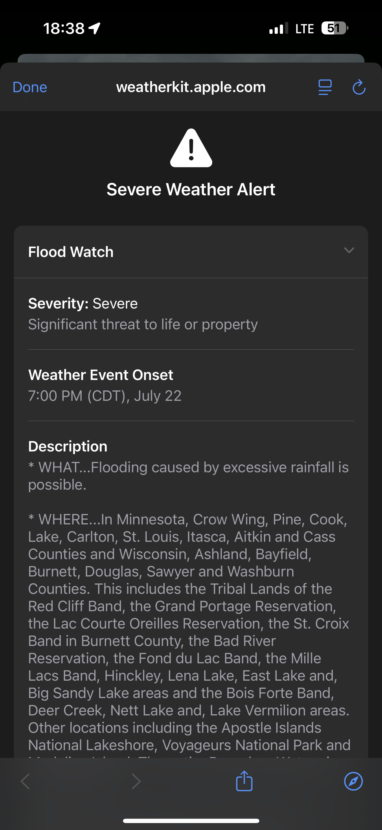
In July, my family tried to replicate this journey, beginning in Lake One, and continuing to Insula Lake State Forest. Nature wasn’t in a mood to cooperate. Before even getting in to the boundary waters, there was a large storm system coming through and severe weather alerts for flooding. Instead of getting an early start, we had to wait until the storms passed and enter the BWCA late in the afternoon. When we reached the outfitters, even their driveway had partially washed out from the heavy rain.
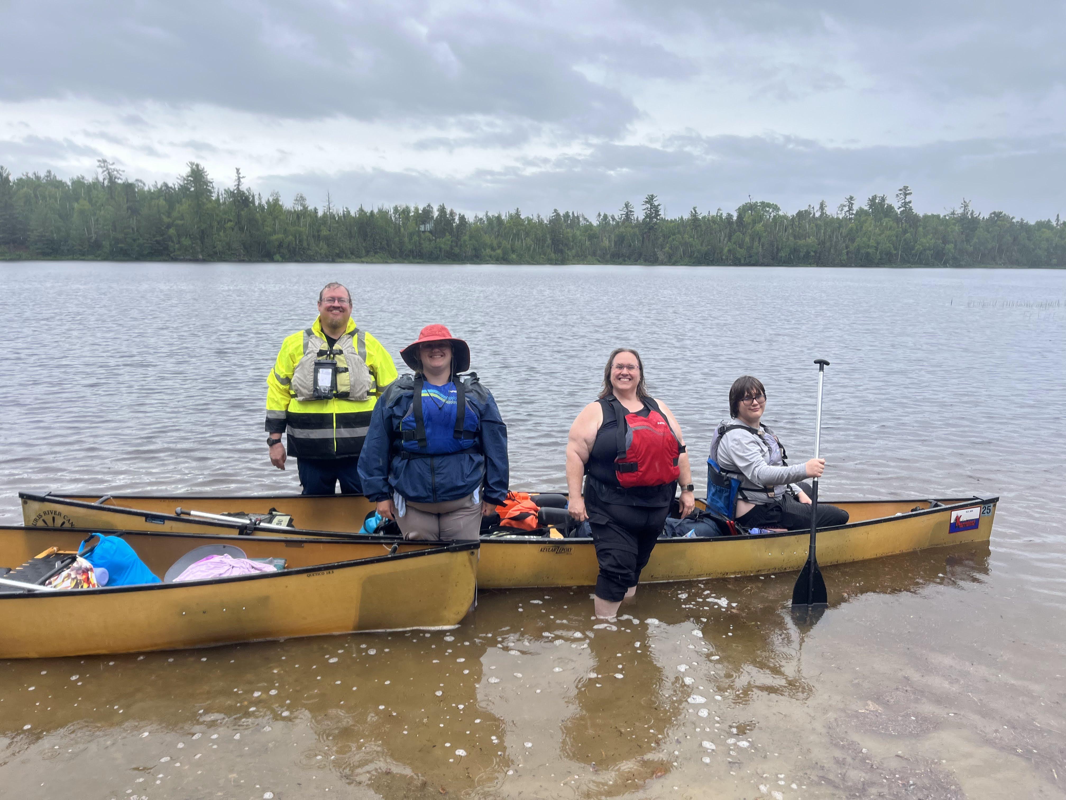
After discussions about the flooding and likely impacts to our trip, we began our journey, with two veterans of previous BWCA trips and two complete newbies…
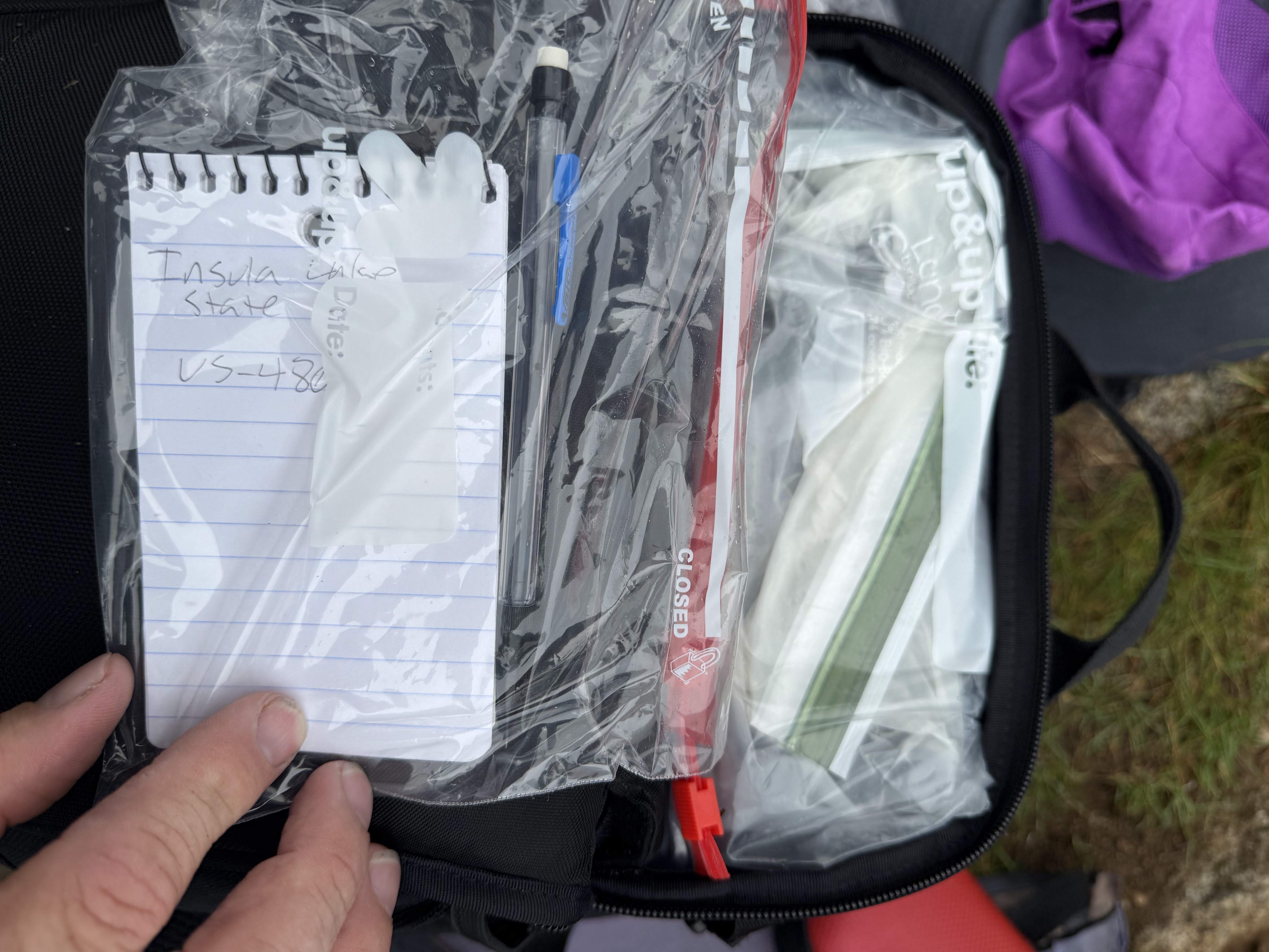
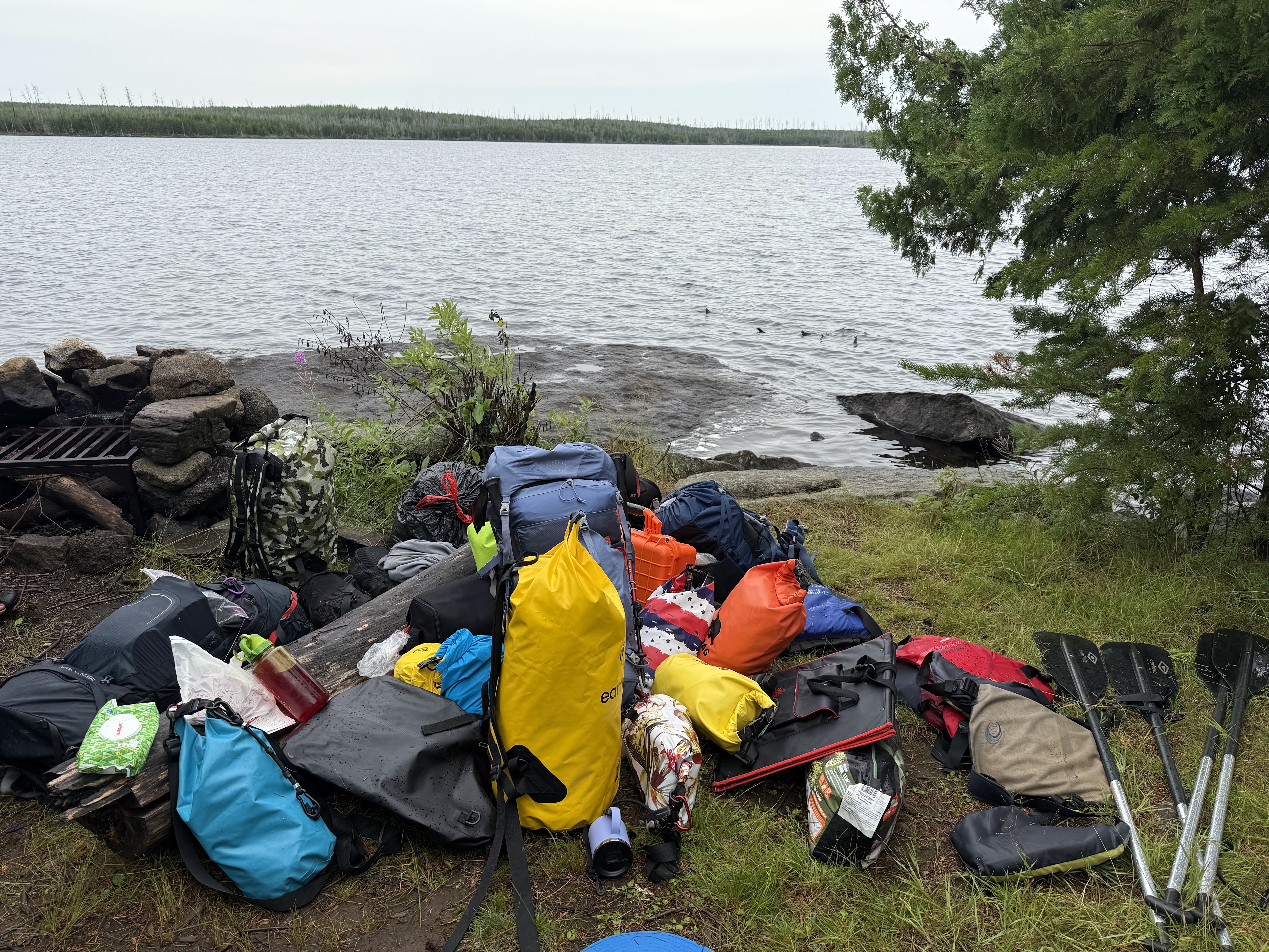
We had two canoes, for four people total, packed up food, tents, supplies, and of course an ICOM 705 radio with three batteries. Each battery, radio, and antenna was packed (or double-packed) in zip lock bags. Decisions were made regarding which things to have more than one of, and make sure all of the cables and parts needed were brought. We stowed four Renology battery packs to run our CPAP devices and keep our phones and devices charged.
These waterproofing methods were put to the test as our first day rained, and there were more than one occasion where our cargo took an unscheduled “dip.” To enter the BWCA on our permit date, and because we had lost so much time, we were basically forced to just get in and find the closest site for the evening.
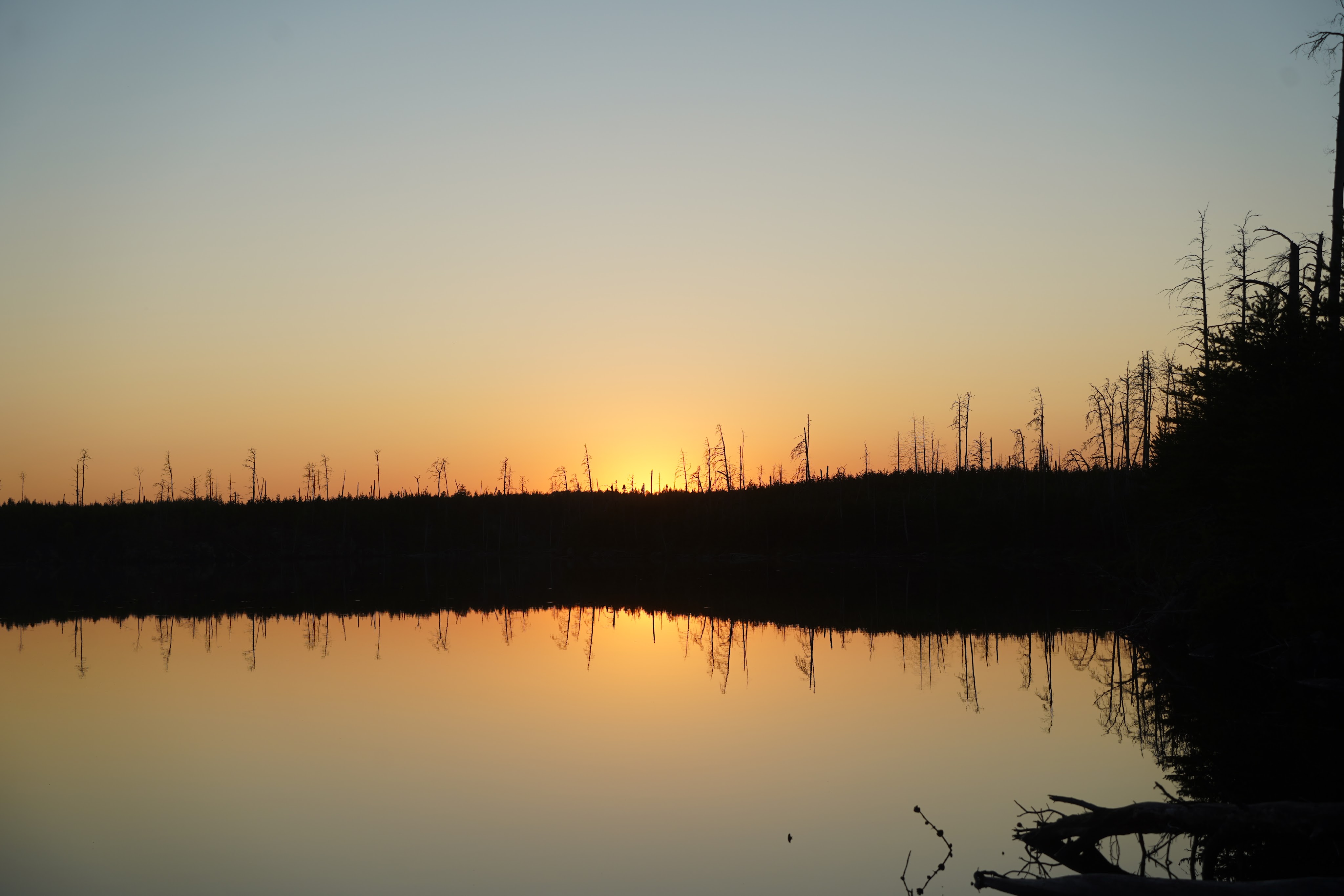
The next few days had better weather.

We used a portable solar panel to recharge our batteries along our trip. These batteries not being water-proof, they too were packaged into zip lock bags before being stowed. We also stowed them under the canoes above the seats so that they could charge without damage in case of rain.
Each phone also had Avenza maps with downloads of the BWCA voyager maps, and also the geotagged state maps for Insula forest. One phone also had the FT4/FT8 software ready to interface with the ICOM radio and make digital mode contacts.
The two canoes were pretty densely packed.

Our original route plan was to enter at Lake One, canoe through to Hudson lake, and then portage into Lake Insula. We got as far as Lake Hudson, and planned to make the longer portage into Insula with less gear and equipment, to make it easier, while tents were set up at Hudson. We only carried what we needed for the radio and the days needs.
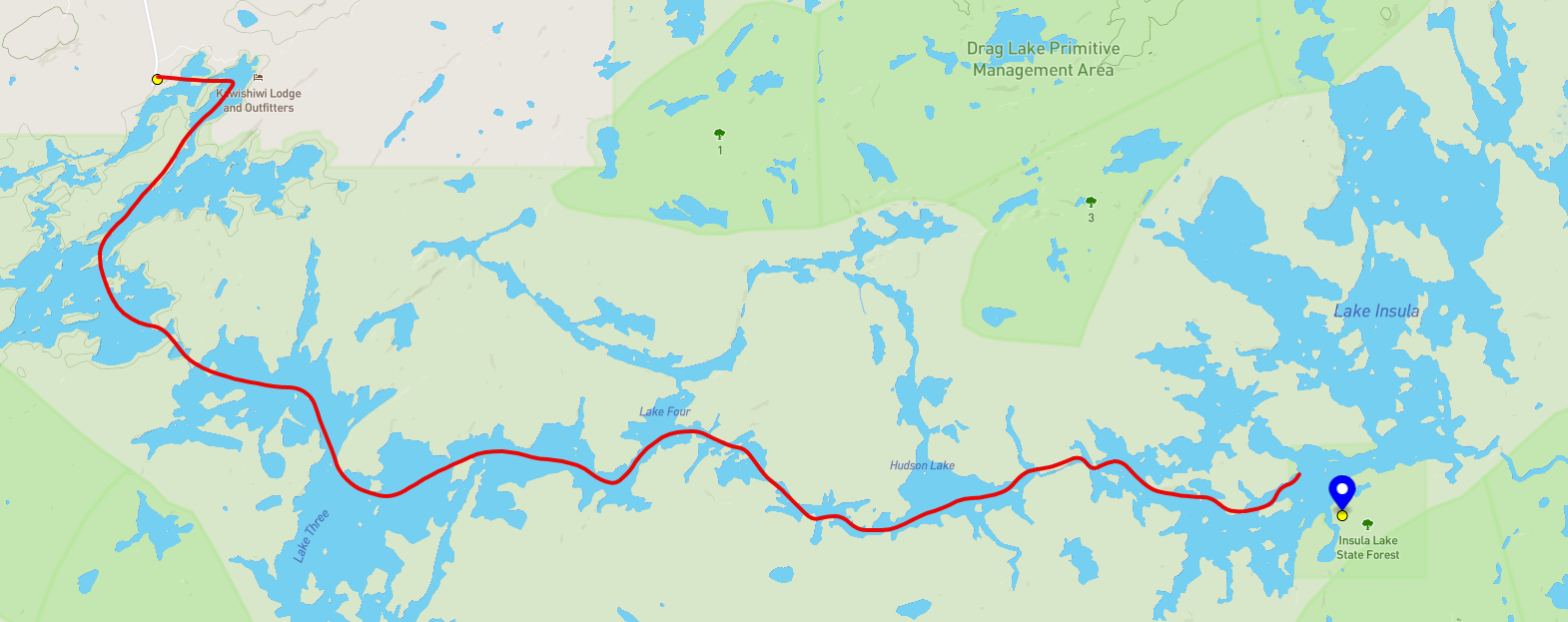
When we got to the insula portage, we found that trying to make this a “day” trip may have been a mistake. The portage was long and high, and the weather was hot and humid. While the crew may be able to work through it once with enough time, the danger was that the return trip time wasn’t knowable, and without all of our camping supplies, that would be an unmanaged risk. We had our water filtering equipment but no contingent shelter (and mosquitoes in the BWCA are no joke). On the map this looks like a 1/3 mile trail. However in person you can see that this trail is largely up and down, not a straight path. On a scale of 1-10, with 10 being the most difficulty, this Hudson to Insula portage has a difficulty rating of 7. That detail wasn’t well understood in advance…

So we decided to return to our campsite on Hudson Lake. We didn’t make it all the way to Insula Lake state forest due to that decision – barely reaching Insula Lake itself but not entering with our canoes. But all was not lost. Instead of setting up inside of Insula Lake, we just paddled back to Hudson and set up the radio at the campsite. Since the entire area is still in the Superior National Forest, even our campsite is a parks on the air destination too.

I put my half-wave end fed antenna in some trees at the highest level I could reach (only about 8 feet), and we got on the air.
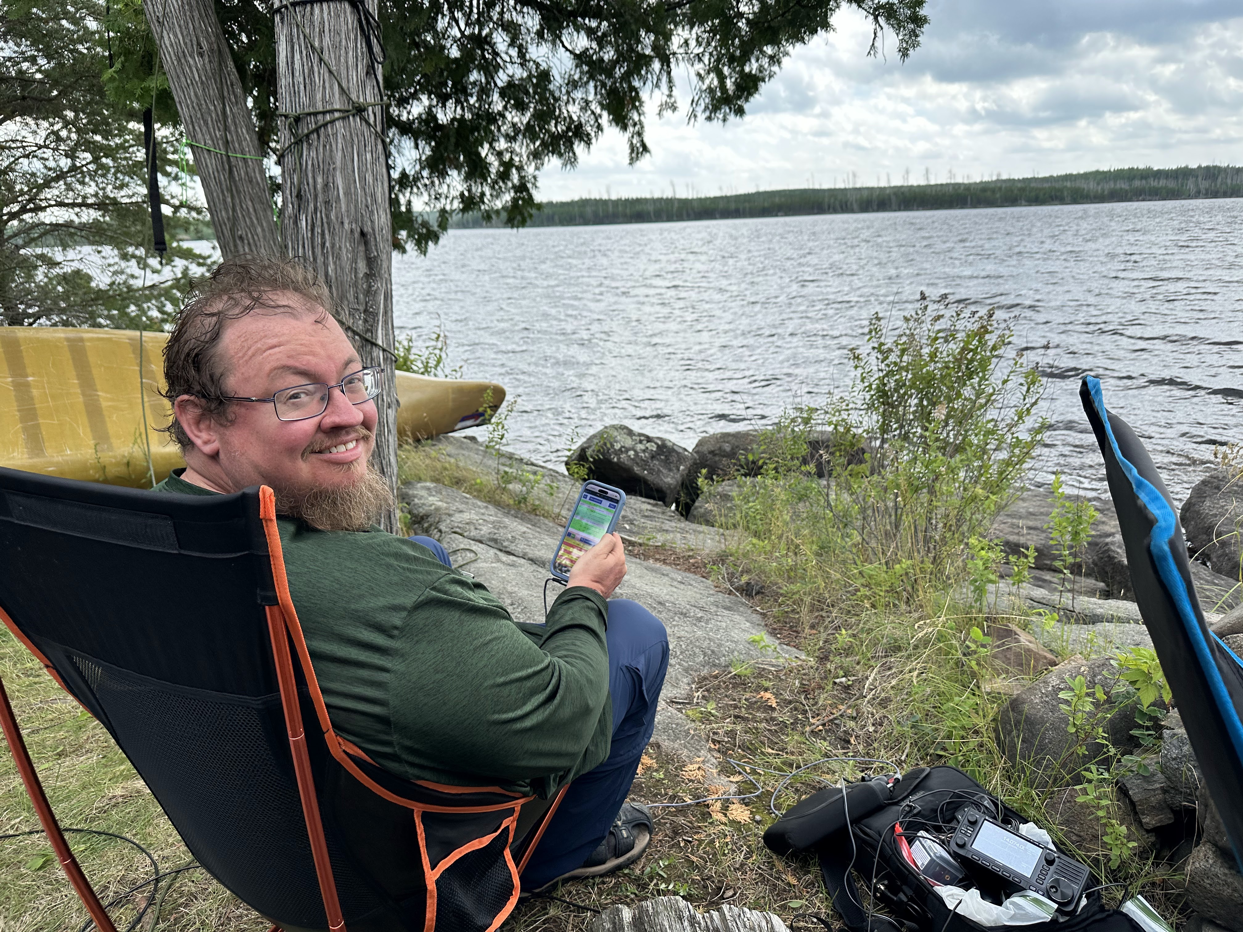
Against all odds, there was still an internet connection via Verizon so I made an attempt to reach out to other ACRC members and tried to make some pre-arranged contacts. The radio propagation wasn’t going to cooperate with that either, with my signal travelling well beyond Minnesota skipping over other MN stations.
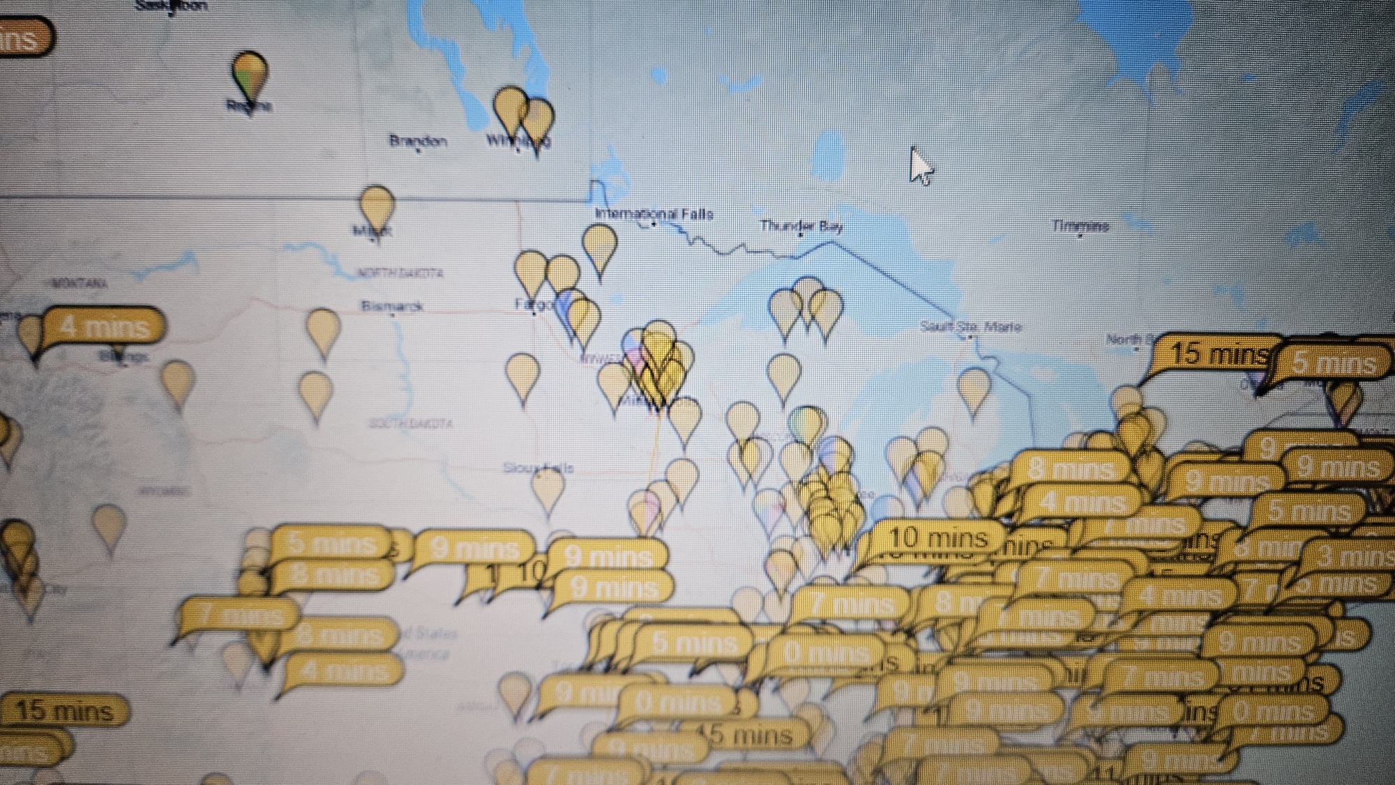
In the end, in a few short hours we had enough contacts to activate the Superior National Forest for two activations with the following locations:

The weather did improve for the exit from the wilderness, and the way out only took one overnight.
If you’re up for an adventure, consider a DX-pedition to Insula Lake State Forest. You may get there, or you may not.
You may need to carry a lot of supplies.
But the scenery will be pretty amazing.

The indoor plumbing and the Dairy Queen sign will also look pretty amazing on the way out.
Tim Neu
N0TJN
